2040 Transportation Master Plan
Recommended Actions


The Transportation Master Plan includes over 100 recommended actions that will ensure Kelowna’s transportation network keeps up with the growth anticipated in the 2040 Official Community Plan. The recommendations will help maintain and renew existing infrastructure, achieve fast and reliable transit, improve road connections, develop safe and connected bicycle routes, create walkable neighbourhoods, and invest in education and emerging technologies.
While this is Kelowna's first comprehensive transportation plan in 25 years, we did not start from scratch. We brought together existing plans, technical analyses, and ideas from residents to create a list of over 400 options. These were evaluated using several methods and the 12 TMP goals, described below.
The TMP recommendations were carefully selected to maximize benefits to our residents, businesses and community, at the best price tag possible. More information on the evaluation process is available in the TMP Scenarios Report.
The TMP builds on the recommendations from several plans and strategies, including the Central Okanagan's new Regional Transportation Plan and the Transit Future Plan, as well as Kelowna's 2040 Official Community Plan and the Pedestrian Bicycle Master Plan. More information on the previous work that informed the TMP is available in Chapter 1.
In addition, options were identified based on the analysis in the Existing and Future Conditions Report, as well as the ideas generated from the public on an interactive map during the Neighbourhood Expos.
We evaluated approximately 400 options using multiple account evaluation, the regional travel demand model, and net-benefit analysis. The multiple account evaluation scored each option based on costs, benefits for different modes of travel, and alignment with policy.
Many of the larger projects were tested using the Regional Travel Demand Model. This model considers where future jobs and residents are likely to be located to estimate future traffic volumes and potential effects on emissions, safety, and travel times.
In Phase 3 we invited people to “sit in the planner's seat” and take part in a budgeting exercise. The goal was to help residents understand the costs and trade-offs associated with transportation investment. Residents were asked how much they would invest in different transportation categories compared to a business-as-usual budget. Basic, medium, and high investment options were offered for each category, along with corresponding estimates of the property tax impacts of each option.
Approximately 1,900 people participated online or in-person. The average budget submitted by members of the public was roughly 20 per cent above our business-as-usual forecast. The results of this exercise guided the TMP’s proposed investments.
To learn more, read the full Phase 3 Engagement Summary.
The options evaluation process was used in combination with public input to build three transportation scenarios. The scenarios included bundles of recommended actions that demonstrated what could be achieved at different funding levels. The 2040 TMP is based on Scenario 2, which used the average budget submitted by the public during the Phase 3 Public Engagement.
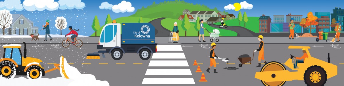
During public engagement, residents told us maintaining and renewing existing infrastructure is a high priority. The TMP recommends working to maintain and improve service levels by increasing investment in maintenance and renewal by approximately 30 per cent. This will help fund activities such as repaving roads, fixing potholes, repairing sidewalks, landscaping, street sweeping, and snow clearing.
Before building new infrastructure, we need to make sure our existing infrastructure is well maintained. The TMP recommends increased service levels for the maintenance of roadways, sidewalks, pathways, and bike lanes. This includes activities such repaving roads, fixing potholes, landscaping, street sweeping, and snow clearing, among others.
In the winter, better clearing of snow and ice will make it safer for people to walk and bike. While we have been clearing off-street pathways and protected bike routes for several years, on-street bike lanes are typically used to store snow in the winter. This can lead to ice, sand, or other debris blocking bike lanes long after a snowfall. The TMP proposes a pilot project to explore ways to clear snow from our most popular bike lanes.
Infrastructure renewal funds activities such as the replacement and repair of aging roads, bridges, sidewalks, and other infrastructure. To achieve higher service levels, the TMP proposes a funding increase of approximately 35 per cent for infrastructure renewal. However, even this level of investment will not fully address our infrastructure deficit. We are currently working to update our asset management systems to get a clearer picture of how much money we need to save for the future.
Together, the TMP and OCP will help reduce the growth of the infrastructure deficit by focusing development in areas that require less infrastructure per unit of new housing – these areas are generally in the Core Area and Urban Centres, where infrastructure costs can be shared among more residents and businesses.
| Maintenance and Renewal | |||||
| ID | Project Name | Project Description | Timing | Municipal Cost | |
| Capital | Operating | ||||
| 1 | Renewal | Accelerated renewal to tackle the Infrastructure Deficit, preventing further deterioration and escalating replacement costs. Assets include roads, bridges, sidewalks, bikeways, traffic signals, streetlights, and multi-use paths. Increase compared to current funding | all years | 149,900,000 | 0 |
| 2 | Bridges Renewal | Additional funding for bridge replacement and rehabilitation. Increase compared to current funding | all years | 10,800,000 | 0 |
| 3 | KLO Rd Mission Creek Bridge Replacement | Replacement of aging KLO Rd Mission Creek bridge in conjunction with the McCulloch Area DCC project. Existing project in the 10-Year Capital Plan Project in the Regional Transportation Plan | 2021-2025 | 8,100,000 | 0 |
| 4 | Maintenance | To achieve higher service levels, this is an increase in maintenance funding that includes additional asphalt resurfacing, pothole repairs, sidewalk repairs, roadway and pathway sweeping, landscaping and improved winter maintenance for sidewalks and bike routes. Increase compared to current funding | all years | 0 | 193,500,000 |
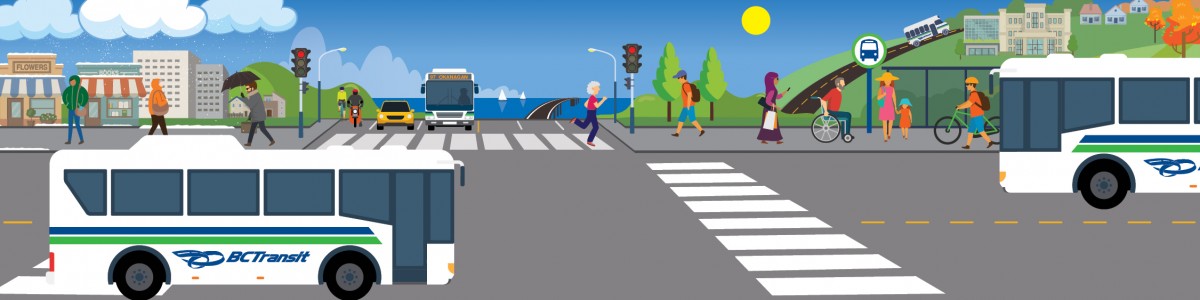
Investing in transit is critical to supporting the 2040 OCP and keeping Kelowna moving as our population grows. The TMP aims to double transit ridership by 2040 and calls for increasing our investment in transit service and infrastructure to make transit faster and more reliable. Transit is the best option for shifting driving trips that are too long to walk or bike.
Kelowna's transit system is a partnership with BC Transit. The City and BC Transit split operating costs, and the City keeps the fare revenue. We are responsible for transit infrastructure such as bus stops and exchanges.
One of the highest priorities is a new Transit Operations Centre. Our existing facility is at capacity and limits our ability to add new transit service. We are working with BC Transit to plan for a new facility. The new facility will allow us to more than double our fleet’s size and is being designed with electric buses in mind. There is the potential for significant federal and provincial funding to support this project due to its alignment with federal and provincial climate priorities.
Harvey Avenue is Kelowna's transportation spine. About half the jobs in Kelowna are within a 10-minute walk of this primary transportation corridor. While the current focus along Harvey Avenue is moving vehicles. Investing in fast and reliable transit will be key to moving more people along the corridor over the long-term.
The TMP is aligned with the Regional Transportation Plan, which recommends adding dedicated transit lanes and enhanced transit service along Harvey Avenue. The project is part of a series of recommendations in the Regional Transportation Plan that work together to create a fast and reliable transit corridor along Highway 97 from across the bridge, along Harvey Avenue, and north to UBC Okanagan (along the future extension of Hollywood Road north to the university).
Dedicated transit lanes along Harvey Avenue will increase the people-moving capacity of the corridor, make more efficient use of the existing road network, and make transit faster and more reliable by allowing transit to bypass traffic and stay on schedule.
Adding dedicated transit lanes to Harvey Avenue would protect space for possible future conversion to light rail or another type of higher capacity transit. This may be possible in the future as the population grows and technology brings costs down.
This project aims to achieve fast and reliable transit without reducing existing vehicle capacity. It is anticipated that as part of the next phase of the Ministry of Transportation and Infrastructure’s Central Okanagan Planning Study will include transit priority improvement projects along Harvey Avenue. Dedicated transit lanes on Harvey are recommended for consideration in conjunction with the Clement Avenue extension project.
The TMP recommends more frequent transit service on our busiest routes, including the Transit Supportive Corridors identified in the 2040 Official Community Plan.
We will focus transit service increases on routes that offer the highest potential for congestion relief and emissions reductions. Several transit routes, such as those that run along Highway 97, Highway 33, Pandosy Street, Glenmore Road, Gordon Drive, Hollywood Road, and Rutland Road will see more frequent service (e.g., bus comes every 10 to 15 minutes during peak hours) and extended service hours (e.g., more buses on evenings and weekends).
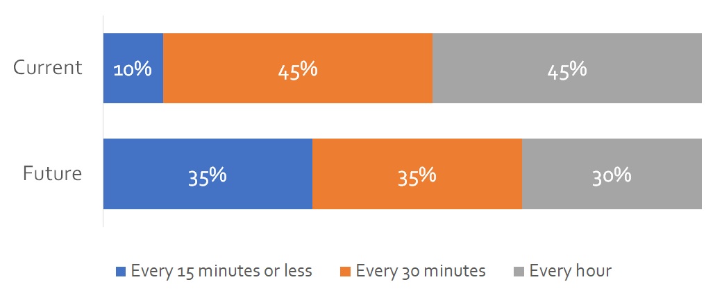
In total, the recommended increases will mean a 65 per cent increase in transit service over the next 20 years. These increases will support new homes and businesses and make transit a viable option for people who live or work near transit corridors.
| More frequent service throughout the day Share of transit service by frequency on a fall weekday | |
 |
It is challenging for transit to compete with driving if buses are stuck in traffic. The TMP includes funds for transit priority infrastructure along key corridors such as Springfield Road, Glenmore Road, Gordon Drive, Hollywood Road, and Rutland Road. New infrastructure such as queue jump lanes and signal priority can make transit faster and more reliable with modest investment.
A successful transit network relies on connections, and transit exchanges are places where many routes come together. The key to successful transit exchanges is making sure they operate efficiently and are comfortable places to be with readily available information for riders.
The TMP recommends leveraging senior government funding for transit infrastructure to pay for upgrades to several transit exchanges. The most significant project is replacing the Midtown exchange near Orchard Park, our second busiest exchange after Queensway. Midtown is unique in that most routes pass through the exchange rather than end there, making it critical for buses to get in and out quickly. Delays of a single minute at a time can add up to tens of thousands of dollars in costs over a year.
Other exchange projects include Okanagan College, an improved transit hub at the Kelowna Airport, and Mission Recreation Centre. The Okanagan College exchange will be modified to improve operations and support future service level increases. Further into the future, the exchange may be relocated as part of expansion plans for the campus.
The transit hub at Kelowna International Airport will be reconfigured to integrate with the airport’s long-term expansion. The Mission Recreation Centre exchange will be improved to address conflicts and delays associated with buses operating in traffic and travelling slowly through the broader site.
As the point of access to transit services in neighbourhoods throughout the city, bus stops should be recognizable, accessible, and comfortable places for people to wait for the bus.
Upgrades to aging or substandard bus stops throughout the city will continue with a focus on high-activity urban stops. Improvements will focus on accessibility and capacity enhancements and providing amenities such as benches, lighting, signage, and shelters, where warranted. Amenities will be prioritized at bus stops near major destinations or at places where two or more transit routes meet. Just like transit exchanges, riders waiting at bus stops have access to real-time arrival information via the Transit App and Next Ride.
| Transit | |||||
| ID | Project Name | Project Description | Timing | Municipal Cost | |
| Capital | Operating | ||||
| 27 | Transit Operating Costs | Increases spending on transit operations including service hours, fleet and operations, maintenance of bus stops, marketing, and administration. Includes projects #27.1, 27.2, 27.3, 27.4, 27.5, 27.6, 27.7. | all years | 0 | 342,610,000 |
| 27.1 | Custom Transit Service | Increase service hours for custom transit (handyDART) by roughly 60 per cent. | all years | - | - |
| 27.2 | Rutland Transit Service | Rutland residents make the most trips by transit of any neighbourhood in the city. This roughly 80 per cent increase in service on Routes 10 and 11 would improve frequency from every 15 minutes to every 8 to 10 minutes during the peak. The layout of routes in Rutland will be reviewed in the future to streamline services, take advantage of new road connections (Hollywood Rd) and better match service with residents’ destinations. | all years | - | - |
| 27.3 | Local Service Investment | While the TMP focuses on the busiest routes in the Core Area, local services still play an important role in enabling access. This package would increase service hours by roughly 40 per cent on local routes. For example, Routes 16 and 17 could have frequency increased from every 30 minutes to every 20 minutes. | all years | - | - |
| 27.4 | Harvey Transit Service | Harvey Ave. is the spine of our transit network. This package would roughly double hours of service on Route 97. It would allow for more frequent service throughout the day, support new homes and employment along Harvey Ave., and build the foundation for future higher capacity transit (e.g., light rail). | all years | - | - |
| 27.5 | Glenmore Transit Service | Glenmore has relatively high potential for transit due to its layout and location “on the way” between UBCO and Downtown. This package would increase hours of service by roughly 55 per cent in Glenmore. Route 6 (Downtown to UBCO) would operate throughout the day instead of only during peak hours. Route 18 (Glenmore to Downtown) and Route 19 (Glenmore to Orchard Park) could also run every 15 minutes during peak hours. | all years | - | - |
| 27.6 | Gordon Transit Service | Transit trips from the Mission that pass through Pandosy, Capri-Landmark, and Downtown travel along Gordon Dr., serving a large area where growth is anticipated. This package would more than double service hours for Gordon (+120%). | all years | - | - |
| 27.7 | Pandosy / Richter Transit Service | Transit service increases for Pandosy St. or Richter St. in alignment with the direction from the Pandosy/Richter Transit Study. This package would roughly double the amount of transit service on Pandosy and Richter. | all years | - | - |
| 27.8 | Airport Transit Service | Extending select trips from the UBCO exchange to the Kelowna International Airport | all years | - | - |
| 28 | YLW Transit Hub | Enhancement of YLW airport transit hub infrastructure, in combination with an increase in service in order to serve both the airport and the Gateway district's industrial and commercial area. *New project Project in the Regional Transportation Plan and Draft Okanagan Gateway Transportation Study | 2021-2025 | 480,000 | 230,000 |
| 29 | Exchange Driver Facilities | Development of two facilities with essential amenities for transit operators, supervisory and security staff at the Queensway and UBCO transit exchanges. *New project | 2026-2030 | 600,000 | 130,000 |
| 30 | FTN Glenmore - Infrastructure | Bus stop improvements along Glenmore Rd, including enhanced shelters, boarding platforms, and transit priority measures. Outfit intersections with transit signal priority to improve transit speed and reliability. *New project | 2031-2035 | 750,000 | 50,000 |
| 31 | FTN Gordon - Infrastructure | Upgrades to bus stops, including the potential for pull-outs, as well as transit signal priority from Dehart Rd to Clement Ave. *New project | 2036-2040 | 1,000,000 | 30,000 |
| 32 | Highway 33 Transit - Infrastructure | Install transit priority measures from Enterprise Way to Rutland Rd to prepare the corridor for higher-order transit services. The improvements will help make transit faster, more reliable, and accommodate higher passenger volumes at stops. *New project | 2036-2040 | 1,210,000 | 60,000 |
| 33 | Springfield Transit - Infrastructure | Upgrades to bus stops, including the potential for queue jumper lanes at intersections, as well as transit signal priority from Pandosy St to Ziprick Rd. *New project | 2036-2040 | 1,300,000 | 30,000 |
| 34 | Highway 97 Dedicated Transit Lanes - Infrastructure | Adding dedicated transit lanes along Highway 97 would create a fast and reliable transit corridor from the bridge to UBC Okanagan. It would make more efficient use of the existing road network, increase the number of people that can move along Highway 97, and allow transit to bypass traffic and stay on schedule. Adding dedicated transit lanes would also protect space for potential future conversion to light rail or other type of transit. This may be possible in the future as the population grows and technology brings costs down. The goal of the project would be to achieve a fast and reliable transit corridor without reducing vehicle capacity. Further study is required to determine the best way to achieve this goal. It is anticipated the project will be part of the next phase of the Provincial Central Okanagan Planning Study. *New project Project in the Regional Transportation Plan | 2036-2040 | 20,000,000 | 0 |
| 35 | Hollywood Rd Transit - Infrastructure | Transit infrastructure in support of new Local ridership services on Hollywood Rd from South Rutland to John Hindle Drive. *New project Project in the Regional Transportation Plan | 2036-2040 | 2,430,000 | 40,000 |
| 36 | Orchard Park Exchange | Redevelopment of the Midtown (Orchard Park) Exchange which has reached capacity during peak periods. The new design will attempt to address the operational challenges with the existing layout stemming from interactions between buses, vehicles, and people walking. Further, the current exchange is located on private property and is not under a formal lease with the landowner. A stable, long-term solution for the facility is required to facilitate future service expansion. May include integration of a mobility hub into the transit exchange design. Existing project in 10-Year Capital Plan - P2 | 2021-2025 | 1,490,000 | 720,000 |
| 37 | Mission Recreation Transit Exchange & Mobility Hub | Serving the current Mission Recreation exchange requires that buses slowly navigate the internal road network of the broader site, often conflicting with other users, particularly in the roundabout fronting H20. This circuitous routing adds to operating costs. A relocated exchange will address these challenges, support an increase in transit trips for the Mission and the recreation complex. May include integration of a mobility hub into the transit exchange design. Existing project in 10-Year Capital Plan - P2 Project is contingent on senior government funding | 2021-2025 | 760,000 | 340,000 |
| 38 | Mobility Hubs at Transit Exchanges | Funding for mobility hubs at Queensway, and UBCO transit exchanges. Mobility hubs are also proposed at other transit exchange locations, and incorporated into those projects (see # 28, 35, 36, 40, and 45). *New project | 2031-2035 | 1,800,000 | 30,000 |
| 39 | Transit - New Bus Stop and Amenities Program | Annual program involving design and construction of new bus stops in support of service changes, installation of new transit shelters, benches, signage and other stop amenities. The program also supports public requests for stop improvements such as accessibility enhancements, as well as coordination with development that occurs along transit corridors. Increase compared to current funding | all years | 3,680,000 | 270,000 |
| 40 | Transit - Land Acquisition | Annual land acquisition funding for bus stops and other improvements. Existing project in 10-Year Capital Plan - P2 | all years | 1,790,000 | 0 |
| 41 | Okanagan College Transit Exchange and Stations | Relocation of the transit exchange to align with Okanagan College’s plans for campus expansion. May include integration of a mobility hub into the transit exchange design. *New project | 2031-2035 | 1,250,000 | 160,000 |
| 42 | Okanagan College Exchange Capacity Expansion | Addition of a bus bay to the existing exchange to facilitate service expansion. *New project | 2021-2025 | 120,000 | 30,000 |
| 43.1 | Pandosy / Richter Transit - Study | The 2040 OCP identifies Pandosy and Richter as ‘Transit Supportive Corridors’, where new housing and commercial will be focused around high-quality transit service. This study will identify needed transit service and infrastructure improvements along the Pandosy and Richter corridors to accommodate future transit demand as this area grows. *New project Project in the Regional Transportation Plan | 2031-2035 | 960,000 | 70,000 |
| 43.2 | Pandosy / Richter Transit - Infrastructure | Infrastructure for frequent service to support increased transit demand between Downtown and the Mission. Pandosy / Richter study will determine required service levels for the Pandosy and Richter corridors respectively. This project may be delivered in parallel with changes to existing Route 1 Lakeshore. *New project Project in the Regional Transportation Plan | 2031-2035 | 960,000 | 70,000 |
| 44 | Route 1 FTN+ Infrastructure | Infrastructure such as upgraded bus stops and transit priority improvements in support of service expansion to FTN+ levels on Pandosy St and Lakeshore Rd. *New project | 2026-2030 | 1,800,000 | 290,000 |
| 45 | Rutland Road FTN+ Infrastructure | Infrastructure such as upgraded bus stops and transit signal priority, to support frequent service on Rutland Road in its role as a ‘Transit Support Corridor’ linking the Rutland Urban Centre with UBCO and the Gateway district. *New project | 2036-2040 | 2,670,000 | 40,000 |
| 46 | Rutland Mobility Hub and Driver Facility | Design, land acquisition and construction of parking lot near the Rutland Transit Exchange for mobility hub and possible park and ride in partnership with BC Transit or private development. *New project | 2021-2025 | 220,000 | 110,000 |
| 47 | Rutland Network Restructure - Infrastructure | Upgrade existing sub-standard stops, construction of new stops in association with network restructuring in north and south Rutland. Existing project Project in the Draft Okanagan Gateway Transportation Study | 2026-2030 | 880,000 | 60,000 |
| 48 | Transit Maintenance & Operations Centre | Development of a new transit operations facility south of UBCO with a larger capacity for buses, maintenance, administration and other functions. The new facility will enable service hour increases targeted in the Transit Future Action Plan and support the planned transition to a low-carbon fleet. Existing project in 10-Year Capital Plan Project is contingent on senior government funding | 2021-2025 | 0 | 10,200,000 |
While the TMP places an emphasis on moving more people with biking, walking and transit, road connections are still an important part of the plan. Road projects were carefully selected to improve traffic safety, support economic growth, optimize travel times, and develop more complete streets - without harming our effort to shift toward sustainable modes of travel.
The Gateway District is a key area for future employment growth that includes UBC Okanagan, Kelowna International Airport and the surrounding lands. The number of trips in and out of the Gateway is expected to grow 65 per cent by 2040. Aside from trips to and from the UBC Okanagan campus, shifting trips away from driving will be challenging.
UBC Okanagan, the Kelowna International Airport, the Ministry of Transportation and Infrastructure and the City partnered to complete the Okanagan Gateway Transportation Study. The study included a series of phased recommendations to support long-term growth and mobility in the Gateway area.
Several recommendations from the Okanagan Gateway Transportation Study have been incorporated into this plan. These include the completion of Hollywood Road from McCurdy Road to John Hindle Drive and the first phase of extending Rutland Road from Old Vernon Road north to the airport. This extension will ultimately connect to an extension of John Hindle Drive using the existing highway overpass, in effect, creating an interchange at John Hindle.
These new connections will add redundancy to the road network in the Gateway area and take pressure off Highway 97. They will also help delay the need for an expensive interchange at Airport Way. As the Okanagan Gateway Transportation Study recommendations benefit jurisdictions beyond the City, partnerships and senior government funding will be needed to complete all the recommendations in the Study.
The Southwest Mission is an existing residential area that will experience some additional growth as it is completed in alignment with the 2040 OCP Growth Strategy. As the area has minimal employment, residents work elsewhere. Due to long distances and steep terrain, the area is car-dependent and residents have few options to avoid traffic congestion.
To help improve the flow of vehicles, we are making significant investments to strengthen a third north-south corridor along South Perimeter Road. This includes downstream improvements along Stewart Road, at the Casorso roundabouts and along Benvoulin Road. These projects will help take pressure off Lakeshore Road and Gordon Drive and will help maximize the corridor’s efficiency, while minimizing impacts to agricultural lands and sensitive ecosystems. In addition to this, the TMP includes the completion of Frost Road (between Killdeer Road and Chute Lake Road).
While these investments will help, the reality is the Southwest Mission will continue to experience traffic congestion, as the driving demand from the area exceeds what is feasible to provide in terms of roadway supply. Seeking to eliminate congestion would require cost-prohibitive road expansions that would negatively impact existing neighborhoods and encourage even more driving and emissions. In addition to the investments proposed, it will be important to encourage residents to work from home, share rides, or drive during off-peak times to help manage growing peak-hour traffic congestion in this area.
On-demand transit, ride-hailing, and e-bikes may also help provide additional travel options. The multi-use pathway on Lakeshore is also recommended for extension further south into the area, as described further in the Biking Section.
The Clement Avenue Extension was previously called the Central Okanagan Bypass, or Multi-Modal Corridor, and was part of a long-term freeway replacement plan for Highway 97. Extending Clement Avenue from Spall to Highway 33 would help take pressure off Enterprise, Highway 97 and Springfield.
In alignment with the Regional Transportation Plan, this project would extend Clement Avenue from Spall Road to Highway 33, with connections at Dilworth Drive and Highway 33. This project is recommended for consideration in conjunction with the dedicated transit lanes project along Harvey Avenue.
No longer envisioned as a freeway, this project includes a two-lane, at grade roadway initially developed to Highway 33 with the long-term vision to extend the road to McCurdy Road. The Okanagan Rail Trail would run adjacent to the new road, though realignment may be necessary along many segments.
Further study, in partnership with the Ministry of Transportation and Infrastructure, is recommended prior to implementation.
Glenmore Road will continue to play an important role in our transportation network as the alternative north-south corridor to Highway 97 that provides access to UBC Okanagan and Lake Country.
The TMP recommends widening Glenmore Road to four lanes and adding a multi-use pathway between Union Road and John Hindle Drive, as well as improvements at the intersection at John Hindle Drive.
North of John Hindle Drive, safety improvements are recommended along Glenmore Road to the border with Lake Country. This would mean straightening corners, creating wider and consistent shoulders, and intersection improvements.
The lack of an east-west route through the Landmark area pushes traffic to Harvey Avenue and Springfield Road – streets that are important routes for long distance trips across the City. As identified in the Capri-Landmark Urban Centre Plan, the Sutherland Avenue extension would be a two-lane complete street from Burtch Road to Spall Road.
The realigned Sutherland Avenue will run through the heart of Landmark and give people driving another option to Harvey Avenue and Springfield Road. It will also provide wide sidewalks, protected bike lanes, and better transit access for people living and working in Capri-Landmark. As Midtown evolves, the extension of Sutherland Avenue beyond Spall Road should be considered.
Rutland Road is one of the busiest parts of our transit network and an important part of the Rutland Urban Centre. The TMP recommends updating Rutland Road from Highway 33 to Leathead to better support the Urban Centre with improved facilities for people walking, biking, taking transit, and driving.
In urban areas, intersections play a critical role in determining a road’s capacity. Intersections are where most serious collisions happen. The TMP recommends annual funding for capacity and safety improvements to major intersections throughout Kelowna. The funds would pay for traffic signals, roundabouts, turning lanes and other key safety and capacity improvements at major intersections.
| Road Connections | |||||
| ID | Project Name | Project Description | Timing | Municipal Cost | |
| Capital | Operating | ||||
| 49 | Benvoulin Capacity Optimization | The project involves maximizing the capacity of Benvoulin Rd, from KLO to Casorso while avoiding widening to a full five lane cross-section, to accommodate growth. *New project | 2026-2030 | 4,000,000 | 260,000 |
| 50 | Burtch 2 (Byrns/Guisachan - KLO) | The project involves the extension of Burtch Rd from Byrns/Guisachan Rd to KLO Rd to accommodate growth. Existing project in 10-Year Capital Plan | 2026-2030 | 11,230,000 | 880,000 |
| 51 | Burtch 3 (Glenmore - Springfield) | Reconstruction of Burtch Rd between Springfield Rd and Glenmore Rd to a four-lane arterial, in conjunction with the redevelopment of Parkinson Rec Centre. It would effectively be an extension of Glenmore Rd to KLO Road (in conjunction with Burtch Extension), increasing network redundancy and north-south connectivity. Includes portions of 5-laning from north of Harvey to south of Springfield. The project includes an ATC facility. *New project Project in the Regional Transportation Plan | 2026-2030 | 18,060,000 | 1,080,000 |
| 52 | Casorso Roundabouts | The project involves optimizing capacity of the Casorso/Swamp and Casorso/Benvoulin roundabouts using the existing Casorso bridge. Capacity will be increased through the addition of auxiliary lanes, widening/lengthening approaches and other upgrades to the roundabouts. *New project | 2026-2030 | 2,620,000 | 140,000 |
| 53 | Clement 1 (Ellis - Graham) | Reconstruction of the south side of Clement as a five-lane arterial between Ellis and Graham to accommodate growth. Existing project in 10-Year Capital Plan | 2026-2030 | 2,360,000 | 200,000 |
| 54 | Clement 2 Extension (Spall - Highway 33) | Extending Clement Ave as a two-lane roadway from Spall Rd to Hwy 33 with at-grade intersections at Spall, Dilworth Dr and Hwy 33. The Okanagan Rail Trail would be preserved, though realignment will be necessary in some sections. This project is recommended for consideration in conjunction with the dedicated transit lanes project along Hwy 97 (#47). Further study, in partnership with the Ministry of Transportation and Infrastructure is anticipated as part of the next phase of the Central Okanagan Planning Study. | 2031-2035 | 37,440,000 | 560,000 |
| 55 | Clement 3 Extension Land (Highway 33 – McCurdy) | Purchase of land to protect a corridor for the Clement Extension from Hwy 33 to McCurdy Rd. Existing project in 10-Year Capital Plan | 2031-2035 | 4,190,00 | 0 |
| 56 | Commonwealth Rd Upgrade | Linking Commonwealth Road to Jim Bailey Rd across the former rail corridor and upgrading Commonwealth to serve both industrial and residential traffic. *New project | 2021-2025 | 7,880,000 | 880,000 |
| 57 | Acland 2 (John Hindle Drive – Airport Way) | This project involves extending Acland Rd from the future John Hindle Extension interchange to Airport Way. This will create a new, direct road connection between John Hindle Dr, Rutland Rd and the Airport as an alternative to Highway 97. Existing project in 10-Year Capital Plan - P2 Project in the Regional Transportation Plan | 2036-2040 | 15,240,000 | 230,000 |
| 58 | Frost 1 (Killdeer - Chute Lake) | Frost Rd extension from Killdeer to Chute Lake Rd directly opposite Okaview Rd (Chute Lake Cr) forming a four-leg roundabout intersection to accommodate growth. Existing project in 10-Year Capital Plan | 2031-2035 | 4,070,000 | 150,000 |
| 59 | Glenmore 5 (Union Rd - John Hindle Dr) | Widen Glenmore Rd to four lanes between Union Rd and John Hindle Dr and improve the intersection with John Hindle, improving safety and capacity along the corridor. The project accommodates growth and will be delivered in conjunction with Glenmore 5 ATC (project ID#103) to complete a gap in the active transportation network. Existing project in 10-Year Capital Plan - P2 Project in the Regional Transportation Plan | 2031-2035 | 16,850,000 | 600,000 |
| 60 | Glenmore Rd Safety Upgrades (John Hindle Dr - Lake Country) | This project is a safety improvement for Glenmore Rd between John Hindle Dr and Lake Country in response to anticipated increases in traffic volumes. The work will involve straightening corners, shoulder widening, and intersection improvements. Land for potential four-laning in the future should be protected. *New project Project in the Regional Transportation Plan | 2031-2035 | 14,820,000 | 620,000 |
| 61 | Gordon Dual Left Turns (Sutherland - Bernard) | The project will upgrade Gordon Dr between Sutherland Ave & Bernard Ave. The upgrades include land acquisition, construction of dual left turn lanes on Gordon Dr at Highway 97, bike lanes, and other intersection works. Existing project in the Capri-Landmark Urban Centre Plan | 2036-2040 | 6,760,000 | 100,000 |
| 62 | Gordon Bridge over Bellevue Creek | The project involves upgrading & widening of the existing narrow bridge. Existing project in 10-Year Capital Plan | 2036-2040 | 2,870,000 | 40,000 |
| 63 | Hollywood 7 DCC (Sexsmith - Appaloosa) Improvements | Portion of Hollywood 7 improvements planned for 2021. Existing project in 10-Year Capital Plan Project in the Regional Transportation Plan | 2021-2025 | 1,780,000 | 200,000 |
| 64 | Hollywood 7 Rd (Hwy 97 - John Hindle) | The project will extend Hollywood Rd N from Highway 97 to John Hindle Dr. Existing project in 10-Year Capital Plan Project in the Regional Transportation Plan | 2026-2030 | 13,110,000 | 790,000 |
| 65 | Hollywood 6 Rd (Rail Trail – Sexsmith) | The project will extend Hollywood Rd N from the Rail Trail to Sexsmith Rd. Existing project in 10-Year Capital Plan Project in the Regional Transportation Plan | 2026-2030 | 790,000 | 50,000 |
| 66 | Hollywood 5 Rd (Hwy 97 – Rail Trail) | The project will extend Hollywood Rd N from Highway 97 to the Rail Trail and will include a new bridge over Mill Creek. Existing project in 10-Year Capital Plan Project in the Regional Transportation Plan | 2031-2035 | 7,470,000 | 310,000 |
| 67 | Hollywood 4 Rd (McCurdy - Hwy 97) | The project will extend Hollywood Rd N between McCurdy Rd and Highway 97 following the existing Findlay Rd. Existing project in 10-Year Capital Plan | 2036-2040 | 7,800,000 | 120,000 |
| 68 | Hollywood 4 Rd (McCurdy - Hwy 97) | The project will extend Hollywood Rd N between Stremel Rd and McCurdy Rd. Existing project in 10-Year Capital Plan | 2036-2040 | 2,850,000 | 40,000 |
| 69 | Lakeshore 1 DCC (DeHart - Vintage Terrace) | The project will complete remaining road upgrades between McClure Rd & Vintage Terrace Rd. A separate DCC AT project will complete a shared-use pathway on the west side. The project will be coordinated with utility upgrades and potential developments in the area. Existing project in 10-Year Capital Plan | 2021 | 310,000 | 40,000 |
| 70 | Lakeshore 1 DCC Bridge at Bellevue Creek | The project will fund construction of Lakeshore Rd bridge over Bellevue Creek. The bridge will include all road features both for vehicular and active transportation. Existing project in 10-Year Capital Plan | 2021 | 2,120,000 | 240,000 |
| 71 | Lakeshore 3 Bridge at Wilson Creek | The project will fund replacement of Lakeshore Rd bridge over Wilson Creek north of Cook Rd. The bridge will include features both for vehicular and active transportation. Existing project in 10-Year Capital Plan | 2036-2040 | 2,810,000 | 40,000 |
| 72 | Lakeshore 3 Rd (Richter – Cook) | Addition of left turn lanes at intersections and sidewalk on east side of Lakeshore Rd. Two-way left turn lane or concrete/tree median (as space permits) to be added between Swordy and Bechard for beautification and access management. Existing project in 10-Year Capital Plan | 2031-2035 | 13,830,000 | 210,000 |
| 73 | Major Intersection Capacity Improvements | The Intersection Capacity Program is targeted to expand vehicle capacity at key intersections. Since intersections are the main constraints in a transportation network, investing in intersections rather than corridor widening is a more cost-effective approach. *New program | all years | 29,720,000 | 2,080,000 |
| 74 | McCulloch Area DCC (KLO/Hall/Spiers) | The project involves realignment of Spiers Rd to form a four-leg roundabout at Hall Rd. The existing Spiers/KLO intersection will be terminated. The realignment will also involve land disposition & acquisition. The project will be coordinated with Mission Creek bridge replacement and utility upgrades. Existing project in 10-Year Capital Plan | 2021-2025 | 3,390,000 | 310,000 |
| 75 | McCurdy Extension (Hwy 97 - Dilworth) | This project will extend McCurdy Rd as an arterial road from Highway 97 to Dilworth Dr, shortening trip distances between Glenmore, Rutland, and the Highway 97 commercial corridor and reducing out-of-direction travel. Existing project in 10-Year Capital Plan | 2036-2040 | 12,130,000 | 180,000 |
| 76 | Road Safety Improvements | Most serious collisions occur at intersections. The Road Safety Program is needed to target intersections with higher collision rates. This program will allow the City to improve one or two intersections every year depending on funding level and the scale of improvements as each location will vary. *New program | all years | 29,950,000 | 2,090,000 |
| 77 | Rutland 2 (Old Vernon Roundabout) | Expansion of the existing roundabout to a multilane roundabout to accommodate future growth. Existing project in 10-Year Capital Plan | 2036-2040 | 5,340,000 | 80,000 |
| 78 | South Perimeter 1 (Gordon – Stewart 1) | The project will construct a 2-lane rural arterial road from the south end of Gordon Dr to the south end of Stewart Rd West to accommodate growth in the South West Mission area. Existing project in 10-Year Capital Plan | 2021-2025 | 9,620,000 | 810,000 |
| 79 | Gordon 1 (Frost – South Perimeter) | The project involves southerly extension of Gordon Dr to South Perimeter Rd to accommodate growth in Southwest Mission. Existing project in 10-Year Capital Plan | 2021-2025 | 0 | 0 |
| 80 | Stewart 3 (Crawford – Dehart) | The project involves construction between Crawford Rd and DeHart Rd and land acquisition only between DeHart Rd and Swamp Rd. The corridor inherits sub-standard geometry. Safety improvements are needed following the construction of South Perimeter Rd. Existing project in 10-Year Capital Plan | 2026-2030 | 7,080,000 | 470,000 |
| 81 | Sector B Deficiencies/Top Lift Paving | Correcting pavement and road surface deficiencies at several locations in the Upper Mission. Existing project in 10-Year Capital Plan | 2026-2030 | 1,780,000 | 120,000 |
| 82 | Traffic Signals & Roundabouts Program | As traffic volumes continue to grow at intersections, roundabouts and traffic signals are warranted to improve traffic control. Partnerships with ICBC have delivered some projects in this program in the past. Existing program in 10-Year Capital Plan | all years | 11,300,000 | 830,000 |
| 83 | Lakeshore 4 (Lanfranco - Richter) | The project will upgrade Lakeshore Rd between Lanfranco Rd and Richter St including urbanization such as curb, boulevard, sidewalk, and protected bike lanes, as development occurs. Existing project in 10-Year Capital Plan | 2021-2025 | 4,610,000 | 390,000 |
| 84 | Richter 1 (Sutherland - KLO) | Urbanization of Richter to support densification from Pandosy urban centre to Downtown with a multimodal corridor. Pandosy/Richter Transit Study will set direction for this project. *New project | 2036-2040 | 31,330,000 | 470,000 |
| 85 | Rutland Multimodal Corridor (Robson – Leathead) | Reconstruction of Rutland Rd as a Transit Supportive Corridor with better infrastructure for people walking, biking, and using transit. *New project | 2036-2040 | 20,160,000 | 300,000 |
| 86 | Sutherland Complete Street (Burtch - Spall) | This project is the extension of Sutherland from Burtch Rd to Spall Rd as a complete street with protected two-way cycle track on the north side. It provides east-west connectivity and facilitates development in Capri-Landmark. Existing project in the Capri-Landmark Urban Centre Plan | 2036-2040 | 38,870,000 | 600,000 |
| 87 | Sutherland Complete Street (Spall - Dilworth) | Design only, for the extension of Sutherland Ave from Spall Rd to Dilworth Dr, with two-way protected cycle track on the north side. The future extension will improve connectivity through Midtown and will encourage economic development in the urban centre. *New project | 2026-2030 | 200,000 | 0 |
| 88 | Urban Centre Improvements | Streetscaping and beautification of key commercial streets in Urban Centres, with a focus on Rutland and South Pandosy. The program will seek inspiration from the success of Bernard Ave., improving conditions for walking, shopping, and patios, and supporting local businesses. *New program | 2025-2040 | 13,550,000 | 200,000 |
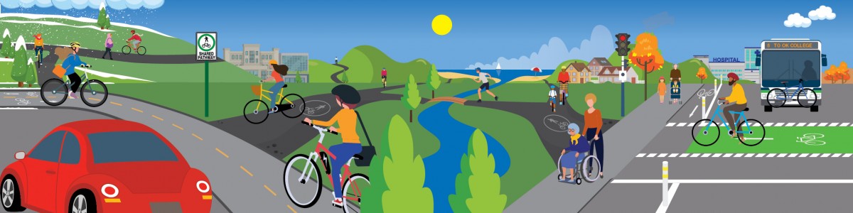
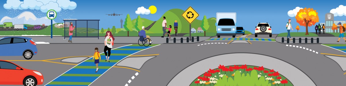
Bicycling is an affordable, healthy and sustainable way to keep Kelowna moving and help people get around without a car. For trips under five kilometres, bicycling can also offer travel times that are competitive with driving.
The TMP aims to quadruple the number of trips made by bicycle by 2040. The key to making biking an attractive option is building a network of comfortable routes protected from traffic. This is an important strategy for accommodating growth in our Urban Centres and Core Area.
The creation of a comfortable bike route between the Okanagan Rail Trail and Mission Creek Greenway is a high priority. Dilworth Drive, Cooper Road, and Leckie Road have all been considered in the past. We are exploring the potential of all three to see which one can be delivered first. Currently, the City is exploring the Leckie connection in conjunction with nearby development.
A lack of comfortable routes currently limits the potential for biking in Rutland. However, a route between Rutland and the Okanagan Rail Trail at Leathead Road will be built in 2022. This new route will tie into the existing Houghton pathway, which will continue to Rutland Road and the neighbourhood beyond. Hollywood Road will be the main north-south bike route in Rutland, going from Mission Creek to the Rail Trail near Sexsmith Road. Rutland has many opportunities for new neighbourhood bikeways.
This part of town is where biking is most popular and has the most potential to grow. As more people and jobs are attracted to these areas, making biking the most convenient option for short trips will be critical to keeping people and goods moving.
As we continue to build our growing network of pathways, the TMP recommends an active transportation corridor (ATC) on Lawrence Avenue to connect the waterfront to the Ethel ATC, as well as continuing to extend the Sutherland Avenue ATC east to Capri-Landmark.
The northeast part of Downtown is expected to grow significantly in the coming years as UBC Okanagan’s downtown campus develops. The TMP recommends a protected bicycle route along Bertram Street to tie into the new Central Green overpass across Harvey Avenue and provide a continuous north-south route through Downtown connecting to the Cawston Avenue ATC. The TMP also recommends extending the Ethel ATC north from Cawston Avenue to connect to the Okanagan Rail Trail.
Abbott Street is an important north-south bicycle route that links many of Kelowna's most popular lakefront parks. A quick-build project using low-cost and interim materials to extend the pathway from Kelowna General Hospital to Gyro Beach is planned for 2022. The TMP recommends making the section from KGH to the Pandosy Urban Centre, near Cedar Avenue, permanent by 2040. The final section from Cedar Avenue to Gyro Beach would be completed after 2040.
Additionally, a new east-west protected bicycle route will be constructed through the Pandosy Urban Centre near Raymer Avenue to connect the Abbott Street and Ethel Street ATCs.
The TMP includes extending the Ethel Street bike route south, past Okanagan College, along Casorso Road to the lakefront at Barrera Road. Along Lakeshore Road, it is recommended to connect the short gap in the pathway in front of Rotary Beach Park. South of Mission Creek, the TMP includes an extension of the Lakeshore Road pathway south from Lexington Road to DeHart Road.
To make it easier to get to the Gateway area, a multi-use pathway will be included in the four-laning of Glenmore Road from Union Road to John Hindle Drive. This will fill a crucial gap for people biking to UBC Okanagan from Glenmore.
The TMP also recommends exploring lower-cost connections to fill the gaps within the existing multi-use pathway network in the Glenmore Valley to create a continuous all ages and abilities bicycling route from just north of Kane Road to the Okanagan Rail Trail.
Lighting and improved snow removal is recommended for the Okanagan Rail Trail to make it more attractive for a longer part of the year. A multi-use pathway connecting UBC Okanagan to Quail Ridge is also recommended to help reduce short-vehicle trips to campus.
| Biking | |||||
| ID | Project Name | Project Description | Timing | Municipal Cost | |
| Capital | Operating | ||||
| 89 | Abbott ATC (Rose - Cedar) | Extension of the Abbott Street active transportation corridor from Rose Ave to Cedar Ave, connecting to the Pandosy Waterfront Park. *Existing project in 10-Year Capital Plan | 2021-2030 | 10,920,000 | 590,000 |
| 90 | Abbott Protected Bike Route (Rose - West) ATC | A pilot project seeking to advance the development of protected bike lanes on Abbott St from Rose Ave to the south of West Ave using interim materials, reducing the gap in the Abbott Active Transportation Corridor (ATC) network and connecting to the Pandosy Urban Centre. *New project | 2021-2025 | 250,000 | 30,000 |
| 91 | AT Corridor/Bike Network Expansion | An annual program to build or improve existing bike lanes, including signs, markings, signals, and trip end facilities. Annual projects are identified in the Pedestrian & Bicycle Master Plan. To maximize the benefits, projects in Urban Centres and the Core Area will be prioritized. Existing program in 10-Year Capital Plan | all years | 10,900,000 | 780,000 |
| 92 | Okanagan Rail Trail Lighting and Improvements | Funding for lighting the Okanagan Rail Trail incrementally from west to east based on trail utilization and user feedback. Existing project in 10-Year Capital Plan | 2026-2030 | 1,260,000 | 90,000 |
| 93 | Burtch 2 ATC (Springfield - Benvoulin) | Active transportation component of Burtch 2 Extension from Springfield Rd to Benvoulin Rd. Existing project in 10-Year Capital Plan | 2026-2030 | 930,000 | 80,000 |
| 94 | Burtch 3 ATC (Glenmore - Springfield) | Active transportation component of Burtch 3 Rd upgrades from Glenmore Dr to Springfield Rd. *New project | 2026-2030 | 1,610,000 | 120,000 |
| 95 | Bertram ATC (Sutherland - Cawston) | Providing a north-south protected bike connection across Downtown to accommodate growth, including the new UBCO campus. *New project | 2021-2025 | 6,730,000 | 320,000 |
| 96 | Casorso 3 ATC (KLO - Barrera) | Protected bike lanes to create a north-south active transportation connection in the South Pandosy urban centre between the Ethel ATC and Barrera ATC. Existing project in 10-Year Capital Plan | 2021-2025 | 6,050,000 | 510,000 |
| 97 | Casorso 4 ATC (Raymer - KLO) | This project will provide a north-south active transportation connection along the South Pandosy urban centre from the Ethel ATC to KLO Rd, also creating a link to Okanagan College. Existing project in 10-Year Capital Plan | 2021-2025 | 670,000 | 80,000 |
| 98 | Bertram/Central Green Overpass | The project includes an overpass for people walking and biking connecting Downtown with Central Green along with considerations for linking to the Sutherland bike corridor and future bike routes in downtown. Existing project in 10-Year Capital Plan | 2021-2025 | 5,500,000 | 630,000 |
| 99 | Rail Trail to Greenway ATC | A north-south biking connection between the Okanagan Rail Trail and Mission Creek Greenway that would also connect to the Midtown Urban Centre. Dilworth Dr, Cooper Rd, and Leckie Rd are possible alignments. If development and funding conditions favour one corridor, the corridor that can be completed the soonest is the priority. Existing project in 10-Year Capital Plan Project in the Regional Transportation Plan | 2021-2025 | 9,590,000 | 630,000 |
| 100 | Ethel 3& 5 ATC (Springfield – Raymer) | Protected bike lanes connecting from Springfield Rd to Raymer Ave. *Completed in 2021 | 2021 | 2,700,000 | 310,000 |
| 101 | Ethel 6 ATC (Cawston - ORT) | Construction of a key bike connection, extending the Ethel St active transportation corridor from Cawston Ave to the Okanagan Rail Trail. Existing project in 10-Year Capital Plan | 2021-2025 | 2,640,000 | 250,000 |
| 102 | UBCO MUP (Quail Ridge - Discovery Ave) | Multi-use pathway connections between UBCO campus and Quail Ridge residential and commercial areas. *Completed in 2021 | 2031-2035 | 1,560,000 | 70,000 |
| 103 | Glenmore 5 ATC (Scenic - John Hindle) | Extension of multi-use path from Scenic Dr to John Hindle Dr as part of Glenmore 5 (project ID #59). *New project | 2031-2035 | 3,220,000 | 170,000 |
| 104 | Glenmore 3 ATC (Clement - High) | Neighbourhood bikeway parallel to Glenmore Road. Alignment study required to determine route. *New project | 2026-2030 | 890,000 | 80,000 |
| 105 | Glenmore 4 ATC (Yates - Dallas) | Multi-use path on Yates, Ballou, and McTavish to close a gap in the active transportation network. Multi-use path link along Kane into village centre is also included. Existing project in 10-Year Capital Plan Project in the Regional Transportation Plan | 2026-2030 | 850,000 | 60,000 |
| 106 | Hollywood 3 ATC (McCurdy - Stremel) | Active transportation component of Hollywood Rd Extension from Stremel Rd to McCurdy Rd. Existing project in 10-Year Capital Plan | 2036-2040 | 520,000 | 10,000 |
| 107 | Hollywood 4 ATC (Stremel - Hwy 97) | Active transportation component of Hollywood Rd Extension from Highway 97 to Stremel Rd. Existing project in 10-Year Capital Plan | 2036-2040 | 1,180,000 | 20,000 |
| 108 | Hollywood 5 ATC (Hwy 97 - Rail Trail) | Active transportation component of Hollywood Rd Extension from the Rail Trail to Highway 97. Existing project in 10-Year Capital Plan | 2026-2030 | 730,000 | 40,000 |
| 109 | Hollywood 6 ATC (Rail Trail - Sexsmith) | Active transportation component of Hollywood Rd Extension from Sexsmith Rd to the Rail Trail. Existing project in 10-Year Capital Plan | 2026-2030 | 330,000 | 20,000 |
| 110 | Hollywood 7 ATC (Sexsmith - John Hindle) | Active transportation component of Hollywood Rd Extension from John Hindle Dr to Sexsmith Rd. Existing project in 10-Year Capital Plan | 2026-2030 | 3,080,000 | 240,000 |
| 111 | Hollywood 9 ATC (Hollydell - Hwy 33) | The work primarily involves urbanizing the west side of Hollywood and modifying the signal at Hwy 33. Some land acquisitions may be necessary. Existing project in 10-Year Capital Plan | 2026-2030 | 5,010,000 | 360,000 |
| 112 | Hollywood 10 ATC (Hwy 33 - McCurdy) | Installation of protected bike lanes on Hollywood Rd from Highway 33 to McCurdy Rd. The project may require reconstruction of the curbs. Existing project in 10-Year Capital Plan | 2031-2035 | 7,590,000 | 270,000 |
| 113 | Hollywood 11 ATC (Springfield - Mission Creek Greenway) | This project completes the segment of Hollywood ATC from Springfield Rd to the Mission Creek Greenway. Existing project in 10-Year Capital Plan | 2031-2035 | 830,000 | 30,000 |
| 114 | Houghton 2 ATC (Hollywood - Mugford) | The project involves extension of the Houghton ATC from Hollywood Rd east to Rutland Rd, completing a key corridor for walking and biking in the Rutland urban centre. Existing project in 10-Year Capital Plan | 2021-2025 | 5,840,000 | 530,000 |
| 115 | Lakeshore 4 ATC (Lanfranco - Richter) | Protected bike lanes component of Lakeshore Rd upgrade between Lanfranco Rd and Richter St. Existing project in 10-Year Capital Plan | 2021-2025 | 260,000 | 20,000 |
| 116 | Lakeshore 3 ATC (Lexington - Old Meadows) | The project will complete the remaining shared-used pathway on the west side between Lexington Dr & Old Meadows Rd. The urbanization on the east side will be incrementally delivered by development. Existing project in 10-Year Capital Plan | 2026-2030 | 5,130,000 | 280,000 |
| 117 | Lakeshore 2 ATC (Old Meadows - Dehart) | The project will complete the remaining shared-used pathway on the west side between Old Meadows Rd & Greene Rd. The urbanization on the east side will be incrementally delivered by development. Existing project in 10-Year Capital Plan | 2036-2040 | 3,390,000 | 50,000 |
| 118 | Lakeshore 1 ATC (DeHart - Vintage Terrace) | The project will complete the remaining shared-used pathway on the west side between McClure Rd & Vintage Terrace Rd. Separate DCC Roads projects will fund the other road features such as Bellevue Creek bridge, curb, gutter, boulevard, bike lane & sidewalk south of McClure Rd. The project will be coordinated with utility upgrades and potential developments in the area. Existing project in 10-Year Capital Plan | 2021 | 400,000 | 50,000 |
| 119 | Leon Lawrence ATC (Waterfront - Ethel) | Complete street project in the Downtown using Leon and Lawrence as a one-way couplet to create a protected bike route between Abbott and Ethel. Existing project in 10-Year Capital Plan - P2 Project in the Regional Bicycling and Trails Master Plan | 2031-2035 | 10,880,000 | 160,000 |
| 120 | Neighbourhood Bikeway Capital Program | Program to construct neighbourhood bikeways on local streets. Neighbourhood bikeways are a lower-cost alternative to protected bike lanes on quieter streets that are suitable for all ages and abilities. Typical projects will include wayfinding signage, traffic calming elements, and crossing signals on major roads to ensure safety and control speeding. *New program | all years | 1,710,000 | 30,000 |
| 121 | Okanagan Rail Trail - Connection to Waterfront Park Pathway | The Okanagan Rail Trail forms an important all ages and abilities walking and bicycling connection between Downtown, UBCO and points in-between. This project closes the gap between the trail’s current endpoint west of Ellis, to Sunset Dr, and then connecting to the Waterfront Park pathway. | 2021-2025 | 250,000 | 30,000 |
| 122 | Pandosy Village ATC (Raymer - Abbott) | The project will deliver an east-west protected bike route connecting the Casorso/Ethel ATC from Raymer Ave with the Abbott ATC through South Pandosy. This will also form a key connection to Okanagan College and Kelowna Secondary. Alignment to be determined. *New project | 2026-2030 | 2,930,000 | 210,000 |
| 123 | Richter 1 ATC (Sutherland - KLO) | Protected bike lanes component of Richter St urbanization to support densification from Pandosy to Downtown with a multimodal corridor. *New project | 2036-2040 | 2,400,000 | 40,000 |
| 124 | Rose 1 Road and ATC (Pandosy - Ethel) – Design only | Design only, for the active transportation corridor on Rose Ave between the KGH and the Ethel ATC. Existing project in 10-Year Capital Plan | 2021-2025 | 200,000 | 0 |
| 125 | Rutland Rd ATC (Robson - Leathead) | Active transportation component of the Rutland Rd reconstruction as a Transit Supportive Corridor. *New project | 2036-2040 | 1,580,000 | 20,000 |
| 126 | Houghton 1 ATC (Houghton - Rail Trail) | The project extends the current Houghton ATC from Nickel Rd to the Rail Trail at Enterprise Way via Leathead. This creates a crucial link for walking and bicycling between Rutland and the Rail Trail. Existing project in 10-Year Capital Plan | 2021-2025 | 2,650,000 | 300,000 |
| 127 | Sutherland 2 DCC ATC (Ethel - Gordon) | Continued extension of the Sutherland two-way cycle track from Ethel St to Lequime St. Existing project in 10-Year Capital Plan | 2021-2025 | 1,070,000 | 120,000 |
| 128 | Sutherland 1 ATC Improvements (Gordon - Burtch) | The project will provide an interim extension of the Sutherland two-way cycle track from Lequime St to Burtch Rd using quick-build materials. Permanent infrastructure will be installed when funds become available. *New project | 2021-2025 | 570,000 | 70,000 |
| 129 | Sutherland 1 ATC (Lequime - Burtch) | The project will extend the Sutherland two-way cycle track from Lequime St to Burtch Rd to provide a critical bike connection between Downtown and Capri-Landmark. Existing project in 10-Year Capital Plan | 2021-2025 | 3,130,000 | 320,000 |
| 130 | Sutherland Complete Street ATC (Burtch - Spall) | Protected cycle track component of the Sutherland Ave extension, which will provide east-west connectivity and accommodates growth in Capri-Landmark urban centre. *New project | 2036-2040 | 1,010,000 | 20,000 |
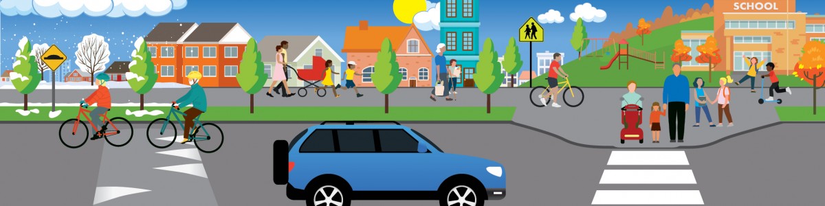
A cornerstone of the 2040 OCP is creating walkable neighborhoods in our Urban Centres and Core Area. The TMP recognizes that safe, walkable neighbourhood streets are critical to keeping Kelowna moving. The plan recommends expanding our sidewalk network, controlling speeding, and investing in safe places for people to cross the street.
The Pedestrian and Bicycle Master Plan identified gaps along collector and arterial roads where sidewalks are missing and flagged them as priorities. Filling these gaps is a long-term project. However, at current funding levels, these gaps will never be filled. To get us back on track, the TMP proposes doubling the funding for the Sidewalk Expansion Program.
Controlling speeding makes local streets more livable and safer for all users. Every year the City receives hundreds of requests from residents who want traffic calming measures installed in their neighbourhoods. The TMP proposes roughly twice the funding for the Neighbourhood Traffic Calming Program. This program funds speed humps, traffic circles, curb extensions and other measures to help control speeding.
A critical component of making Kelowna more walkable is adding safe places to cross busy roads. The TMP proposes roughly two and half times the funding for safer crossings. Increased funding will help install or reconfigure crosswalks, flashing beacons, or traffic signals where warranted. Crosswalks near schools, parks, and bus stops will be prioritized.
The Sidewalk Expansion Program mentioned above only covers collectors and arterials. For local streets, the City currently collects a deposit from developers for future improvements in front of their properties. However, it can take a long time to collect enough money to update an entire street, even on blocks with significant redevelopment. Updating local streets with sidewalks, boulevards, and trees one property at a time as they are redeveloped, is inefficient and often leaves gaps.
The TMP recommends creating a new Local Street Urbanization Program to pool contributions from development, local residents and the City to build complete local urban streets, including sidewalks, more quickly.
| Neighbourhood streets | |||||
| ID | Project Name | Project Description | Timing | Municipal Cost | |
| Capital | Operating | ||||
| 5 | Crosswalk Safety, Signals and Flashers | Increased investment in crosswalk safety to improve travel for people walking and biking. People walking and biking are injured primarily at marked crosswalks and at unsafe crossing locations. This program targets the problem locations with improvements such as yellow flashing beacons, countdown timers, audible signals, and pedestrian signal heads. Highest priority will be given to crosswalks connecting key destinations (e.g., schools, parks, bus stops) in the Urban Centres and Core Area. Existing program in 10-Year Capital Plan Increase compared to current funding | all years | 4,280,000 | 300,000 |
| 6 | Neighbourhood Traffic Calming Program | Additional investment in neighbourhood traffic calming to accommodate traffic growth throughout the city. Traffic calming to reduce vehicle speeds and improve safety for pedestrians and bicyclists is a critical action for making neighbourhoods more attractive and walkable. Potential locations for speed humps, traffic circles, and curb extensions, and other measures are selected based on technical evaluation and neighbourhood support. Existing program in 10-Year Capital Plan Increase compared to current funding | all years | 2,550,000 | 180,000 |
| 7 | Sidewalk Network Expansion | Accelerate construction of the sidewalk network outlined in the Pedestrian and Bicycle Master Plan (PBMP). Highest priority will be given to sidewalks connecting key destinations (e.g., schools, parks, bus stops) in the Urban Centres and Core Area. Existing project in the 10-Year Capital Plan Increase compared to current funding | all years | 17,900,000 | 1,270,000 |
| 8 | Local Street Urbanization Program | Invest in sidewalk, street trees and urbanization on local streets where infill development is occurring. *New program | all years | 7,900,000 | 590,000 |
Not all investments in transportation involve building new infrastructure. Education and incentive programs can help people learn how to use and enjoy new ways of getting around. Additionally, emerging technologies such as ride-hailing, carshare, e-bikes and e-scooters can make it easier to get around without owning a car. Even small investments can have a big influence on people’s travel choices and congestion.
The TMP recommends creating education, training, and incentive programs to help support people learning to bike and take transit. Funding for a Transit Travel Training program will help older adults and young people better navigate the transit system as new riders (expanding on the pilot program currently underway). To make it easier and more affordable to take transit, the TMP recommends expanding the transit pass program for post-secondary students, major employers, and low-income residents.
The TMP also recommends expanding the Safe Routes to School Program and increasing safe bicycle skills training for Kelowna elementary students through the Bike Rodeo program. Training would not stop with children, however. Riding a bicycle in a city can be intimidating for adults who may not know the rules of the road. This is why the TMP also recommends bicycle skills training for adults.
Learning to navigate Kelowna by bike or transit is not the only barrier people face. The TMP recommends the development of an Accessibility Transition Plan to help better understand and address the challenges faced by people with disabilities when navigating the transportation network.
With our rapidly expanding bicycle network it will be important to keep our wayfinding signage and bicycle maps up to date, both digitally and in print. The TMP recommends funding these items to ensure both residents and visitors can find the best route for their trips.
As we build out our transportation network, it will be important to ensure people know how to use the new travel options available to them. The TMP recommends an individualized trip planning program to help residents and employees in different parts of the city try new ways of getting around.
One of the most cost-effective ways to manage traffic congestion is to reduce the number of people traveling to work or school during the morning and afternoon rush hours. The estimated value of the time and emissions savings for the average Kelowna resident who works remotely is $25 a day.
Employer Commute Trip Reduction programs work with employers to help identify incentives and options to help reduce the number of employees driving alone during peak travel times. The TMP includes funds to develop and test a pilot Employer Commute Trip Reduction Program tailored to our community.
To reduce the number of injuries and fatalities on our transportation network and ensure everyone can get to their destination safely, the 2040 TMP recommends the development of a comprehensive Transportation Safety Strategy. This will help protect vulnerable road users, such as people walking and biking, and save lives across all modes.
To help prepare for increased demand on curb space from ride-hailing, deliveries, and shared mobility, the 2040 TMP recommends the development of a Curb Space Management Strategy.
To help goods move efficiently and foster a growing economy, the 2040 TMP recommends the development of a Regional Goods Movement Strategy. This was also a recommendation in the Regional Transportation Plan and is currently underway.
The TMP recognizes that emerging technologies are creating new ways for people to get around. Often these emerging modes are “shared” which means they can be rented for a single trip with a smartphone. Emerging technologies such as ride-hailing, carshare, e-bikeshare and e-scooter-share will be important parts of how people get around in the future. The TMP recommends leveraging the benefits of emerging technologies and includes a program to help deliver these options successfully.
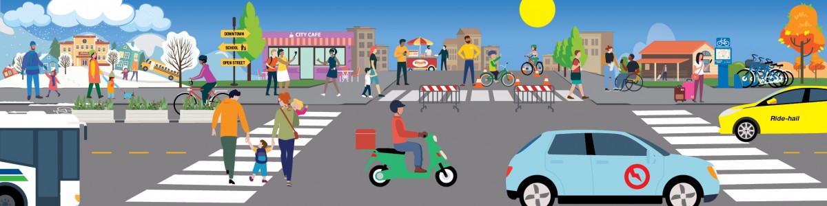
Quick build infrastructure allows us to respond more quickly to community needs and try out new ways to make streets safer, livelier, or more inviting for people walking and biking. It means we can involve residents in testing out options and improving designs before making major capital investments.
The temporary closure of Bernard Avenue started as a response to the pandemic and enabled outdoor dining. However, opening the street to people has proven to be popular with residents, businesses, and visitors. The TMP recommends establishing an annual budget for Open Street pilot projects that facilitate outdoor dining, festivals, and social events on other streets to test effectiveness.
| Education, programs and emerging technologies | |||||
| ID | Project Name | Project Description | Timing | Municipal Cost | |
| Capital | Operating | ||||
| 9 | TDM Existing Funding | Reflects existing spending on Transportation Demand Management, Education, Incentives, and Shared Mobility. | all years | 0 | 2,000,000 |
| 10 | Accessibility Transition Plan | As recommended in the City’s Community for All Action Plan, this project involves developing an Accessibility Transition Plan to ensure sidewalks, crossings and intersections meet the needs of people with disabilities (e.g., people in wheelchairs, mobility scooters or with limited vision and hearing). Accessibility design guidelines will be incorporated into Bylaw 7900 and priority areas for retrofits will be identified. *Project in progress | 2021-2025 | 0 | 80,000 |
| 11 | Adult Bicycle Skills Training | Help train new adult riders proper biking techniques and rules of the road to build confidence and skill level. Match new riders with experienced riders for rides to increase skill and comfort level. *New program | all years | 0 | 360,000 |
| 12 | Bike and Ped Individualized Marketing Strategy | Create targeted and neighbourhood specific programs to encourage walking and biking. This may be tied to capital projects to improve the walking and biking network within the neighbourhood. *New project | 2026-2040 | 0 | 450,000 |
| 13 | Bike Map Program | Develop and produce physical bike maps for residents and visitors, update them as the network is expanded. Increase compared to current funding | all years | 0 | 190,000 |
| 14 | Wayfinding Program | Planning, installation, maintenance and operations for wayfinding signage on active transportation facilities. Increase compared to current funding | all years | 0 | 190,000 |
| 15 | Community Electric Vehicle & E-Bike Strategy -Implementation | Implement the Community Electric Vehicle & E-Bike Strategy to provide enhanced access to EV Charging stations and promote the use of electric bicycles. Option: Seek out additional funding sources to provide e-bike purchase incentives and/or rebates for income-qualified residents. This would be a cost-effective option to help reduce driving and progress toward climate objectives. Existing project | 2022-2030 | 1,080,000 | 180,000 |
| 16 | Curbside Management Plan | Develop a strategy to prepare for increased demand on curb space from ride-hailing, deliveries, and shared mobility. This will be important for managing competing demands within our Urban Centres and maximizing the value of curb space. *New project | 2026-2030 | 0 | 50,000 |
| 17 | Goods Movement Strategy | Develop a regional strategy for supporting goods movement, including deliveries and curb management, and policies to right-size delivery vehicles in Urban Centres. *Project in progress | 2021-2025 | 0 | 60,000 |
| 18 | Employer Commute Trip Reduction Program | Development and implementation of a program to encourage, support and incentivize commuting via sustainable modes of travel and reducing peak-hour single occupancy vehicle trips. The program will include partnerships with employers to promote work from home or commuting via, bike, walk, transit, or small-electric vehicles. Option: Seek out additional funding sources to more fully fund this program once it is developed. The societal benefits in terms of time savings, emissions, and safety benefits, for every remote worker is estimated at $1,000 - $1,500 annually. This action could be a cost-effective way to reduce driving and help meet climate objectives. *New project | all years | 0 | 570,000 |
| 19 | Open Streets | Closing streets to cars temporarily for festivals and social events, starting with pilot projects. Annual budget for pilot projects. *New project | all years | 0 | 430,000 |
| 20 | Safe Routes to School Expansion | The Safe Routes to School Program helps provide schools with travel planning and infrastructure improvements to make it safer for students to bike or walk to school. Maximizing the number of students biking and walking to school is a cost-effective strategy for managing peak hour traffic congestion and improving public health. Funding increases by an additional $50,000 a year (bringing total to $100,000 a year) would allow the program to serve all Kelowna schools in 10 to 15 years. Option: Work with School District 23 to find ways to increase the number of students taking either school buses or public transit to school, for example by lowering the distance threshold for busing students and/or considering other criteria such as steep grades or the need to cross major roads that make biking or walking to school less practical. Recognize that school busing is a cost-effective way to help reduce peak-hour traffic congestion, and reduce greenhouse gases from transportation. Existing program in 10-Year Capital Plan | all years | 1,860,000 | 110,000 |
| 21 | Emerging Technologies and Shared Mobility Program | Create incentives for emerging technologies and shared mobility services to launch and operate in wider geographic areas, ensure access to low-income residents, and reduce emissions from operations. *New project | all years | 0 | 960,000 |
| 22 | Student Bike Skills Training Expansion | Develop a graduated bicycle education program that includes bike rodeos, and more intensive sessions based on HUB Cycling’s Learn to Ride program for Kelowna elementary students. The goal is to have all students in Kelowna receive basic safe cycling training by Grade 6. Increase compared to current funding | all years | 0 | 450,000 |
| 23 | Tactical Urbanism Pilot Project | Experiment with quick-build infrastructure and temporary materials to create cost-effective transportation infrastructure or beautification projects like curb extensions, protected bike lanes, sidewalks, quickly responding to challenges with an interim solution outside of the traditional capital planning process. *New program | all years | 0 | 950,000 |
| 24 | Transit Pass Program Expansion | Expansion of transit pass programs to improve the affordability and convenience of transit service. Possibilities include expanding the UPass program to Okanagan College students; employee passes for people working at Interior Health, UBC Okanagan and other major employers; and the introduction of discounted passes for lower-income residents. Option: Seek out additional funding sources to more fully fund discounted monthly transit passes for lower-income residents. In addition to supporting equity and inclusivity goals, this action could be a cost-effective way to help meet climate objectives. Increase compared to current funding | all years | 0 | 3,100,000 |
| 25 | Transit Travel Training Program | Formalize general transit training to encourage and empower people to use conventional transit. Focus on youth to develop a culture of transit ridership as well as older adults and persons with disabilities to support mobility independence. Explore providing training to working age adults to reduce reliance on personal autos. Youth/Adult 50+ program piloted 2020-21 | all years | 0 | 860,000 |
| 26 | Transportation Safety Strategy | Through public engagement, staff heard that transportation safety is a top priority for residents. This study would examine transportation safety issues in Kelowna comprehensively and help identify a safety policy and key strategies to reduce fatalities and injuries for all travelers. *New project | 2021-2025 | 0 | 80,000 |